 EN
EN IT
IT  FR
FR 


Details Subsoil Model
Subsoil Model
Back
- Last Update: 2025-08-22 12:12:03
- Id: 80
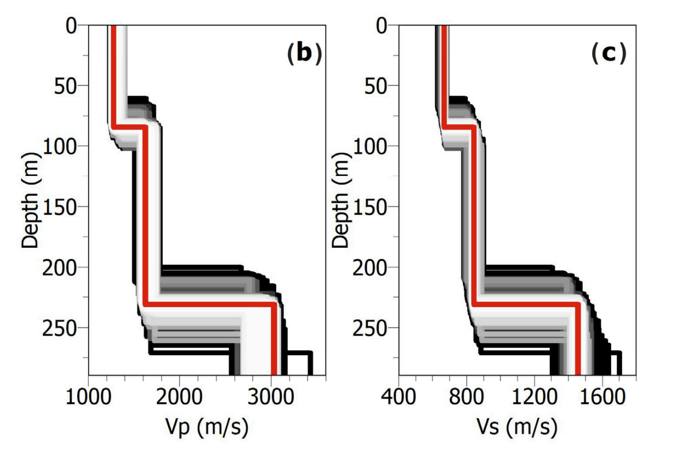
- Type: VELOCITY_PROFILE
- Latitude: 40.829447
- Longitude: 14.149329
- Elevation: 108
- Range of interest:
- Site name: CSTH
- Site Distance:
- Note:
- Survey date: 30/05/2022 00:00:00
-
Figure:
 Monography:
Bibliography
| Title | Id_type | Id | Url | |
|---|---|---|---|---|
| Nardone L., Morelli R. S., Gaudiosi G., Liguoro F., Galluzzo D., Orazi M., First Steps Towards Site Characterization Activities at the CSTH Broad-Band Station of the Campi Flegrei’s Seismic Monitoring Network (Italy)., Sensors (2025) | DOI | Https://www.mdpi.com/1424-8220/25/15/4787 | https:/... |
Velocity Profile
| Type | Preferred | Graphic Depth Model |
|---|
| SA | Y |
|
